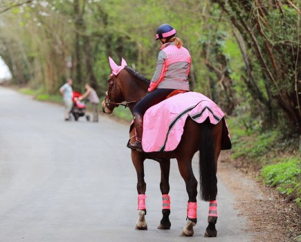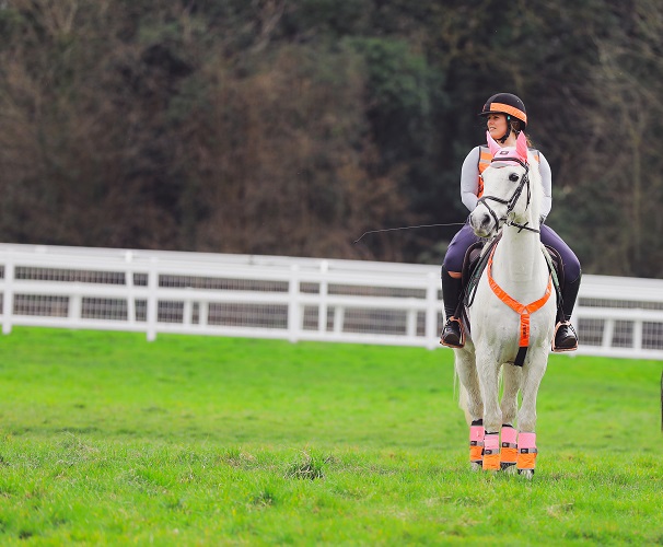
Make the most of your hacking time by planning the route you’re going to ride. Here’s how…
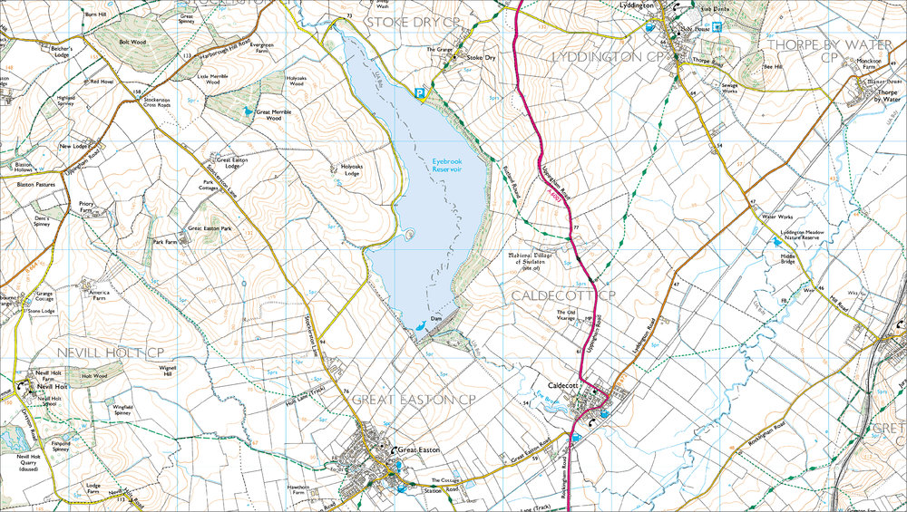
The first thing you need to do when planning a new or longer ride is get yourself an Ordnance Survey (OS) map of the area you’re intending to ride.
The orange-covered OS Explorer series has a 1:25,000 scale (meaning four centimetres equals 1km (2 ½ inches to one mile)).
What you’re looking for are bridleways, byways and restricted byways – horses are allowed on these along with a range of other users so familiarise yourself with your map and learn how to read it accurately before you set off anywhere.
You can download a guide to all types of OS maps from www.ordnancesurvey.co.uk
Understanding your map will also help you unlock the potential of unsurfaced, unclassified roads, which are just that – old roads which have never been surfaced or classified as A, B or C roads by the local highways authority.
These can be quite hidden, and that’s why you want your map. You can go for a lovely long off-road ride if you use them as well as bridleways – there’s around 500 miles of them in north Yorkshire, so although some areas have fewer than others they do exist.
When choosing a route, research parking for your trailer or lorry – some car parks offer dedicated spaces for this, while guided routes will often list where parking is available.
If you’re drawing up your own route consider whether you’ll need to drive down beforehand to suss out parking, or contact the area’s BHS access officer for advice – they can also help with route information.
Who can roam where?
There are four types of public right of way, which may be marked with signposts and/or colour-coded waymarkers – check you’re on track with our quick-reference guide:
- Footpath – open to walkers only.
- Bridleway – open to walkers, horse-riders and cyclists; cyclists must give way to walkers or horse-riders.
- Restricted byway – open to walkers, cyclists, horse-riders and horse-drawn vehicles.
- Byway open to all traffic – open to walkers, cyclists, horse-riders, horse-drawn vehicles and motor vehicles
Other types of access include permissive access, where a landowner allows people to access their and for walking, cycling or horse-riding, and unsurfaced, unclassified roads (UUCRs).
These are sometimes colloquially known as ‘green lanes’, can range from well-defined tracks to narrow paths and are usually marked in white (rather than red) or labelled as ‘other roads with public access’ (ORPAs) on OS maps.
Riders can also use some commons and urban commons, but as common land is a complex topic, check with the local highways authority before riding there. In Scotland, the law allows everyone access to most land and inland water for non-motorised activities, including walking, horse-riding and cycling, provided they do so responsibly.
Ordnance Survey mapping © Crown copyright 2012 Media 050/12
How to read the map:
- Short green dashes: footpath
- Long green dashes: Bridleway
- T-shaped alternate green dashes: Restricted access byway
- Crossed green dashes: Byway open to all traffic
- Short orange dashes: Permissive access footpath
- Long orange dashes: Permissive access bridleway
Check out these long-trek bridleways
North England: The Pennine Bridleway. Stretching from Derbyshire to Cumbria, this National Trail follows everything from old packhorse routes to newly created bridleways. The 130-mile southern section, including the circular 47-mile Mary Towneley Loop, was officially linked a couple of years ago with the northern section, completing the 205-mile route.
South-West England: The Ridgeway. This National Trail runs through Hertfordshire, Buckinghamshire, Oxfordshire, Berkshire and Wiltshire, and is Britain’s oldest road. More than half the 85-mile route is byway, and there are plenty of other riding routes nearby. At its eastern end, the Ridgeway joins the Midshires Way and the Icknield Way, and the Three Downs Link joins it to the South Downs Way.
East of England: The Three Shires Way. Totalling 37 miles this route runs from Tathall End in Buckinghamshire, through Bedfordshire to a circular 12.4-mile route around Grafham Water in Cambridgeshire.
Scotland: The Tyne Esk trails, Midlothian. These trails offer 60 miles of riding on four circular routes, each ranging from eight to 13.5 miles in length.
Wales: Dolanog route, Dyfnant forest, Powys. This 11-mile circular route mixes roads and tracks, plus a wide river crossing. It starts from the horsebox-accessible car park at Penyffodd, Dyfnant, where a number of waymarked rides and carriage routes, called the Rainbow Trails, also start.
Northern Ireland: Greyabbey toll ride, Ards Peninsula , Co Down. This privately-owned estate is home to a circular four-mile off-road, purpose-built riding trail which passes through woods and estate land. A large trailer park is available at the head of the marked trail. Riders require BHS membership and toll ride membership to use the trail.
Find our listed rides and many more at Ride UK, the BHS’s national bridleroute network website – www.ride-uk.org.uk